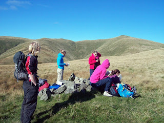
Every year around this time we devote a meet to navigation, a training day aimed at giving members a chance to learn and develop essential skills such as map reading and taking bearings.
This year, taking over from Roger Wild, we were grateful to have the assistance of Heather Morning, Mountain Safety Advisor with the MCofS, who provided a morning lecture and then tuition during the day to one group.
Most of the other attendees grouped with an experienced member of the club and set off from Tillicoultry on various routes around the Ochil Hills.
It was a lovely day - something of a break with navigation meets in recent years - which presented no navigational difficulties, but no-one seemed to be complaining!
Exercises covered the basics you'll find in the MCofS' "Navigator's Dozen", comprising the 12 most important navigation skills: setting the map, taking bearings, interpreting contours, estimating distances, and so on.
Most groups ended up on Ben Cleuch, at 721m the highest point, with The Law presenting a quick but steep descent route back down to Tillicoultry.
Overall, another well-attended meet in exceptional weather, and people generally seemed happy with the navigational aspects of the trip. Our thanks once again to Heather Morning of the MCofS for lending her time and expertise.
For more information on the skills training opportunities offered by the club, please see the DURC website.


No comments:
Post a Comment